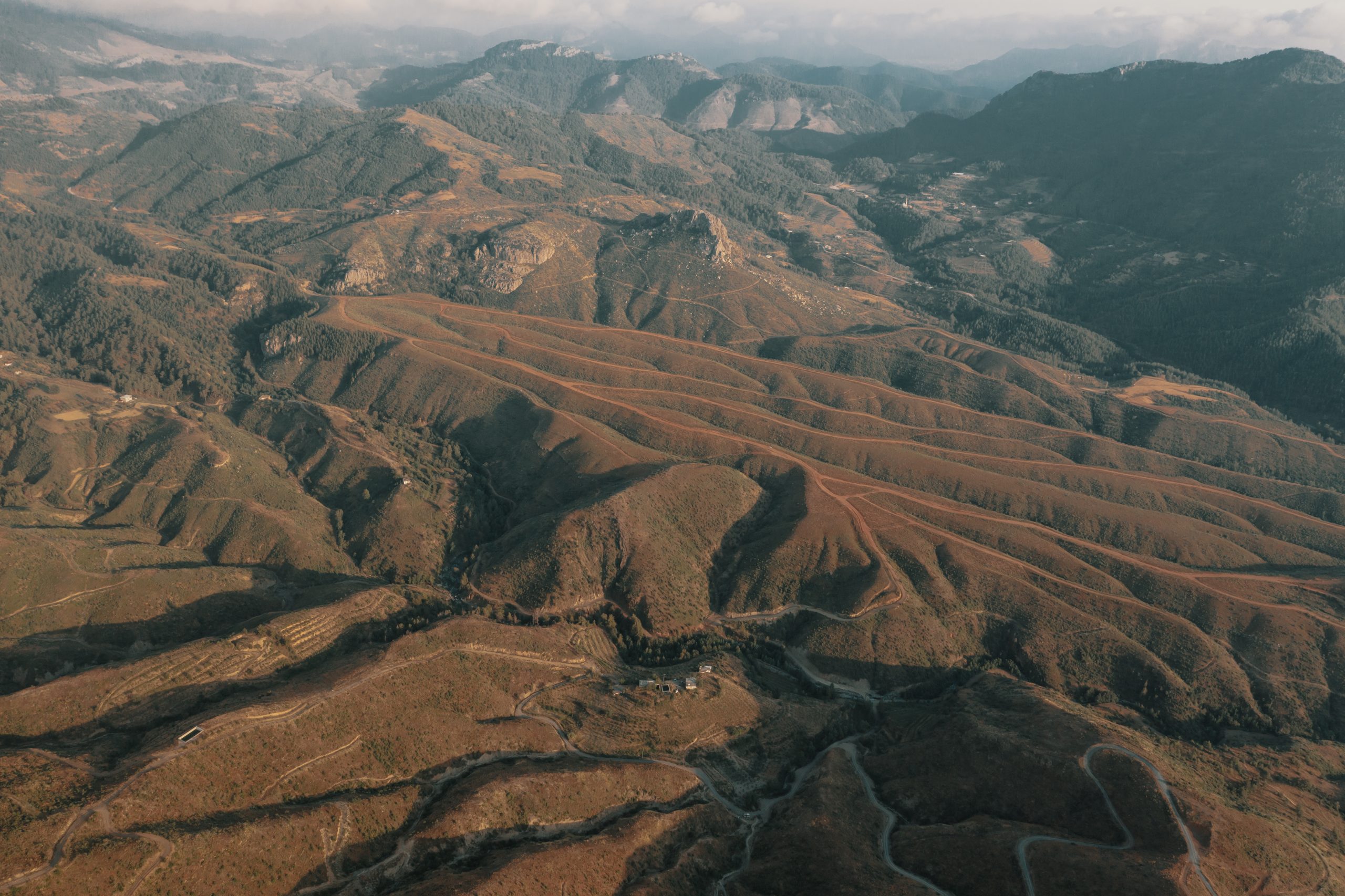
Exploring mineral deposits and accessing resources has consistently demanded funding, alongside advanced technology and carefully planned approaches in the past years. The integration of satellite information has led to a shift in these sectors that is molding the direction of resource exploration moving forward.
Through the utilization of satellite pictures combined with assessments and sophisticated data analysis techniques businesses now have the ability to pinpoint mining locations, track environmental consequences and fine tune operational effectiveness with an accuracy that was previously incomprehensible.
The Role of Satellite Data in Modern Resource Exploration
The use of satellite data has significantly changed how we explore resources today by providing a budget friendly method compared to conventional techniques The shift is made possible through the following essential components;
1. High-Resolution Imagery for Remote Sensing
- Satellite sensors take high resolution pictures of the Earth’s surface to spot alterations in landscapes and vegetation that could signal the existence of minerals or oil reserves.
- Various types of wavelengths (such as light and infrared) offer details about the makeup of the land and plant life present there; this aids in identifying regions with fertile soil containing minerals.
2. Broad Area Coverage and Accessibility
- Satellites have an advantage over ground surveys as they can efficiently map remote regions in the past due to their ability to cover vast areas without being restricted by geographic accessibility constraints.
- Satellite data collection is able to operate on challenging landscapes or political boundaries; this allows for exploration in regions that would otherwise be difficult to access.
3. Advanced Analytics and Machine Learning Integration
- Companies have the ability to use machine learning algorithms on satellite data to detect patterns and irregularities that may indicate the presence of resource deposits.
- By combining satellite data with geochemical information data fusion methods improve the precision of exploration efforts.
Enhancing Geological Mapping and Target Identification
Mapping the Earth’s geology has typically required a lot of work. Taken up a significant amount of time in the past. However thanks, to satellite information this procedure has been transformed into an more task offering several benefits;
1. Detailed Mineral Mapping
- Satellites, with hyperspectral imaging technology can. Map different minerals across the Earth’s surface by analyzing their distinct spectral patterns.
- This helps focus on exploration areas and lessens the need for drilling and sampling efforts.
2. Detecting Geological Structures and Fault Lines
- High quality satellite images help us spot features, like faults and folds that play a key role, in how mineral deposits are formed.
- By integrating satellite information, with gravity investigations we gain an understanding of what lies beneath the surface.
3. 3D Geological Modelling
- Data obtained from satellites is combined with information to generate three dimensional representations that illustrate the location and shape of mineral reserves.
- These models aid, in planning, by enhancing the precision of forecasts regarding where resources are located and the feasibility of extraction.
Optimizing Operations with Continuous Monitoring
Satellite information isn’t just valuable for exploration. Also plays a role in the ongoing supervision of mining activities with continuous monitoring aiding in optimizing operations through real time insights.
1. Environmental Monitoring and Regulatory Compliance
- Satellites monitor alterations, in land use patterns and the well being of vegetation to evaluate how mining practices affect the environment.
- Regulations frequently require, in depth monitoring reports and satellite information can offer proof of adherence to these rules.
2. Risk Management and Safety Monitoring
- Satellites equipped with Synthetic Aperture Radar (known as SAR satellites) have the ability to identify ground movement, like displacement and subsidence as other alterations that indicate possible dangers such as landslides.
- Identifying these risks helps mining companies proactively address them and lower the chances of accidents and disruptions, in operations.
3. Remote Monitoring of Equipment and Infrastructure
- We can remotely monitor the state of infrastructure, like roads and pipelines using satellite data.
- Identifying indicators of strain or deterioration assists, in planning maintenance, at the time to avoid breakdowns and reduce downtime.
Mitigating Environmental Impact with Advanced Analytics
Impact on ecosystems by mining and exploration can be reduced with the help of satellite data tools that enable companies to adopt a responsible approach, through analytics.
1. Land Use Change Detection
- With high quality satellite images, we can monitor shifts in how land’s utilized spotting signs of deforestation or loss of habitats due to mining operations.
- This information assists businesses in creating strategies for restoration or adjusting their practices to minimize their impact on the environment.
2. Monitoring Water Resources
- Changes, in the characteristics and size of water features, to mining areas can be identified using satellite information.
- By observing these shifts in the environment and trends, within the industry sectors concerned with water management practices and regulations compliance companies can detect risks of contamination at an early stage and take necessary actions to safeguard the integrity of water sources.
3. Predictive Environmental Modelling
- Using analytics on satellite information researchers can model the effects on the environment based on various mining scenarios.
- Companies can use models to modify their strategies and prevent consequences by finding the right equilibrium, between utilizing resources and protecting the environment.
Exploration of Remote and Challenging Areas
One important advantage of utilizing satellite information for exploration is its capability to reach difficult to access areas that allow for the identification of resources, in regions that would otherwise go undiscovered.
1. Exploring Harsh Terrains
- Areas, with weather conditions, tough terrains or dense woods pose obstacles for conventional exploration efforts.
- Satellite information tackles these obstacles by providing a down perspective that enables exploration teams to evaluate characteristics without physically visiting the location.
2. Cross-Border Exploration
- Political or security concerns frequently restrict entry into areas of the world.. Satellites have the capability of collecting data from regions without the necessity of crossing borders offering valuable insights, for worldwide research and exploration purposes..
- This method is especially beneficial, for global corporations looking to expand their range of resources.
3. Ice and Arctic Exploration
- Satellite information proves to be useful, for studying areas due, to the difficulties posed by ice and snow coverage that render traditional approaches unfeasible.
- Remote sensing technologies have the capability to observe alterations in the thickness of ice and recognize formations hidden beneath the surface.
Improving Efficiency and Reducing Costs
Exploring resources can come with a price tag; however satellite information provides opportunities to streamline the process and save money.
1. Reducing Field Survey Costs
- Before heading out for fieldwork expeditions begin to make sure to pinpoint areas of interest using satellite data to reduce the necessity for ground investigations.
- This method does not cut costs. Also speeds up the process of exploration which helps businesses introduce resources to the market more quickly.
2. Optimizing Drilling Programs
- Exploration drilling can be quite costly and satellite information is valuable, in identifying locations which can minimize the need for exploratory wells.
- This focused drilling strategy results in improved extraction of resources. Reduces the expenses of the project.
3. Remote Site Management
- Satellite information helps cut down on the necessity, for, on site inspections since real time data can be easily accessed from any location.
- Firms have the capability to oversee operations from a distance to enhance the allocation of staff and assets.
Enabling Data-Driven Decision-Making
In today’s data driven mining industry landscape making informed decisions can greatly improve project results. Satellite data plays a role, in achieving this by;
1. Integrating Multiple Data Sources
- By integrating satellite images, with surveys and historical records, alongside geochemical data analysis is a practice to gain a holistic perspective of exploration locations.
- This method of combining data from sources helps to make predictions about the quality of resources and the feasibility of extraction processes.
2. Predictive Analysis and Forecasting
- Analyzing trends in satellite data helps predict obstacles, like equipment malfunctions or environmental hazards that may arise over time.
- Companies can use analysis to anticipate issues and improve their day, to day processes in advance.
3. Strategic Resource Management
- Satellite information guides the decision making process for mining projects by helping determine where to place infrastructure and how to manage waste while scheduling resource extraction activities effectively.
- This methodical strategy helps organizations effectively utilize resources while upholding sustainability practices.
Addressing Compliance and Regulatory Challenges
Mining activities are bound by rules and guidelines, with a focus placed upon safeguarding the environment’s well being and sustainability practices in place to support companies in complying with these regulations and utilize satellite information extensively.
1. Documenting Environmental Compliance
- Satellite images offer evidence of how land’s utilized and how the environment evolves over time – making it simpler to show adherence to regulations.
- Continuous monitoring promotes openness and responsibility that can help foster improved connections with bodies.
2. Community and Stakeholder Engagement
- Illustrating handling of resources using satellite information can aid in addressing the worries that communities have regarding the effects of mining activities.
- Involving stakeholders, with precise and timely information fosters trust and bolsters the community’s approval, for our operations.
3. Navigating International Regulations
- Operating in locations can be made easier for businesses, with the use of satellite data as it offers an uniform source of environmental data to comply with diverse regulatory standards.
- This consistency guarantees that the tasks related to compliance are made efficient across regions.
The Future of Satellite Data in Resource Exploration
The use of satellite data in mining and natural resource exploration is expanding with the emergence of technologies offering the prospect of enhanced insights and creative applications, in the future.
1. Next-Generation Satellites
- Satellites that are upcoming will have improved resolutions and advanced sensors that will help in detecting subsurface characteristics and mineral compositions with accuracy.
- Enhancements in radar technology and hyperspectral imaging are set to enhance exploration capabilities.
2. Artificial Intelligence and Automation
- The use of AI is expected to increase in the analysis of satellite information to automate the detection of areas in resources and forecast operational difficulties.
- When drone technology and IoT sensors work together with AI driven analytics systems they can enhance automated exploration processes.
3. Sustainable Mining Practices
- The incorporation of satellite information into sustainability efforts can assist mining firms in reaching their objectives.
- Monitoring the impact of mining operations and improving resource efficiency will become easier, with the use of satellite based tracking systems.
Conclusion: Partnering with Envision Beyond for a New Era in Exploration
Envision Beyond is committed to revolutionizing mining and natural resource exploration through the use of advanced satellite data and analytics. Our solutions empower companies to explore new frontiers, optimize resource extraction, and minimize environmental impact. With a focus on innovation and sustainability, Envision Beyond offers the tools needed for successful and responsible resource exploration.
Contact us today to learn how our satellite-based solutions can transform your exploration efforts.