Illegal mining has become a critical global issue, leading to severe environmental, economic, and social consequences. It depletes natural resources, contaminates water bodies, contributes to deforestation, and threatens the livelihoods of legal mining operations. Traditional monitoring and enforcement methods have long struggled to keep pace with the scale and sophistication of these activities.
Advanced Geospatial Intelligence (GeoInt) is now reshaping how governments, environmental agencies, and organizations tackle illegal mining. By leveraging satellite imagery, AI-driven analytics, and predictive modeling, authorities can gain real-time insights, automate surveillance, and take proactive action against environmental exploitation.
This blog explores the extent of illegal mining, the challenges of enforcement, and how GeoInt is revolutionizing the fight against environmental exploitation with cutting-edge technologies.
The Growing Crisis of Illegal Mining and Environmental Destruction
Illegal mining operations have expanded rapidly, particularly in regions rich in gold, diamonds, coal, rare earth minerals, and other valuable resources. These activities are often conducted without proper permits, environmental assessments, or legal oversight.
The scale of illegal mining is staggering, with reports estimating that:
- Over 28% of global gold production may originate from illegal mining.
- In the Amazon, illegal mining contributes to 10% of deforestation annually.
- Mercury poisoning from unregulated gold mining has contaminated thousands of water sources, affecting millions of people.
- Governments lose billions in tax revenue annually due to illicit mineral trade.
Key Environmental and Economic Consequences
1. Widespread Deforestation and Land Degradation
Illegal mining leads to large-scale deforestation, soil erosion, and habitat destruction. In regions like the Amazon, illegal miners clear vast areas of land to access gold-rich riverbeds, leading to biodiversity loss and long-term environmental damage.
2. Water Contamination and Toxic Waste Dumping
Many illegal mining operations rely on mercury, cyanide, and arsenic to extract precious metals. These chemicals often end up in rivers and groundwater, poisoning aquatic life and impacting communities that depend on these water sources.
3. Economic Disruptions and Loss of Government Revenue
Illegal mining undermines the formal mining industry, leading to job losses, revenue deficits, and market distortions. Governments lose critical tax income that could be used for infrastructure, social programs, and conservation efforts.
4. Security and Human Rights Violations
Illegal mining is frequently linked to organized crime, child labor, human trafficking, and corruption. Criminal organizations often control illicit mining operations, using profits to fund illegal activities such as drug trafficking and armed conflicts.
Given these severe consequences, a data-driven, technology-enabled approach is required to detect, track, and combat illegal mining effectively. This is where Geospatial Intelligence (GeoInt) comes into play.
How Advanced GeoInt is Revolutionizing the Fight Against Illegal Mining
Traditional enforcement relies heavily on manual patrols, whistleblower reports, and local informants, which are often ineffective in remote areas where illegal mining thrives. GeoInt offers a game-changing solution, providing continuous, real-time monitoring using advanced technologies such as:
- Satellite and aerial imagery for large-scale environmental monitoring.
- AI-driven data analytics to detect anomalies and illegal activities.
- Hyperspectral and thermal imaging for identifying hidden mining operations.
- Predictive analytics to forecast future hotspots of illegal mining.
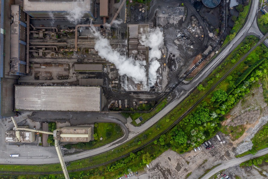
1. High-Resolution Satellite and Drone Monitoring
Satellite imagery provides a powerful way to track illegal mining activities across vast, remote, and inaccessible locations. High-resolution images can detect land-use changes over time, helping authorities pinpoint new and expanding illegal mining sites.
Drone surveillance offers additional support, enabling real-time, high-detail monitoring in areas where satellite imaging might be limited by cloud cover or dense forests.
Key Benefits:
- Large-scale monitoring of forested and remote areas.
- Detection of unauthorized land clearing and excavation.
- Tracking of mining expansion trends over weeks, months, or years.
2. AI-Powered Image Analysis and Pattern Recognition
With millions of square kilometers to monitor, manual analysis of satellite images is impractical. AI and machine learning algorithms process massive datasets in real time, detecting changes that indicate illegal mining activities.
Machine learning models can differentiate between legal and illegal mining operations by identifying:
- Unusual land disturbances that do not align with known permits.
- Abnormal water discoloration, indicating chemical contamination.
- Heavy machinery movements detected via thermal imaging.
Key Benefits:
- Rapid identification of illegal mining sites with high accuracy.
- Reduction in human effort for data analysis.
- Early detection of environmental damage.
3. Thermal and Hyperspectral Imaging for Hidden Mining Sites
Illegal miners often operate at night or under dense forest canopies to avoid detection. Thermal sensors detect heat signatures from mining machinery, revealing hidden sites even in challenging environments.
Hyperspectral imaging analyzes light reflected from the ground to identify specific minerals being extracted, distinguishing between legal and illegal operations based on mineral composition.
Key Benefits:
- Detection of unauthorized extraction in remote areas.
- Identification of illegal mining at night or under dense vegetation.
- Tracking of toxic waste disposal through spectral analysis.
4. Predictive Analytics for Proactive Prevention
Beyond detecting current illegal mining activities, predictive models analyze historical and socio-economic data to forecast where illegal mining is likely to occur next.
Factors analyzed include:
- Past mining activity patterns.
- Proximity to unregulated deposits.
- Economic and political instability in a region.
Authorities can use these insights to proactively deploy resources and prevent new illegal mining operations before they begin.
Key Benefits:
- Prevention instead of reactionary enforcement.
- Optimized allocation of enforcement teams.
- Reduction in future environmental damage.
Strengthening Law Enforcement and Policy with GeoInt
GeoInt is not just a monitoring tool—it plays a critical role in law enforcement and policy-making by:
- Providing real-time alerts to enforcement agencies.
- Generating legal evidence through high-resolution images and AI analysis.
- Enhancing cross-border collaboration for international law enforcement.
By integrating GeoInt insights with policy frameworks, governments can create more effective regulations that balance economic growth with environmental sustainability.
Envision Beyond: Leading the Future of GeoInt for Environmental Protection
At Envision Beyond, we specialize in cutting-edge Geospatial Intelligence solutions that empower governments, organizations, and environmental agencies to detect, prevent, and mitigate illegal mining.
Why Envision Beyond?
- Advanced Satellite and AI Integration – Combining high-resolution imagery with AI analytics for precision monitoring.
- Predictive Intelligence – Identifying illegal mining risks before they escalate.
- Customizable GeoInt Solutions – Tailored for enforcement agencies, environmental regulators, and conservationists.
Illegal mining doesn’t have to remain an unchecked problem. With Envision Beyond’s GeoInt-driven approach, governments and organizations can enforce regulations, protect natural resources, and secure a sustainable future.
Visit Envision Beyond to explore how our GeoInt solutions are transforming environmental protection and illegal mining enforcement.