Elevate Your Geospatial Capabilities with DEM & DTM data
Accurate elevation data is essential for a wide range of applications, from urban planning and infrastructure development to environmental monitoring and disaster management. Envision Beyond’s Digital Elevation Models (DEM) and Digital Terrain Models (DTM) provide high-resolution, precise elevation data that enhances your geospatial analysis and decision-making processes. Our cutting-edge solutions offer detailed insights into the Earth’s surface, enabling you to make informed decisions with confidence.
The DEM & DTM Solution
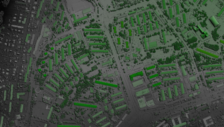
Envision Beyond's DEM and DTM data utilize advanced data acquisition technologies and sophisticated processing techniques to deliver accurate and reliable elevation models. Whether you need to analyze topography, plan construction projects, or assess environmental impacts, our DEM and DTM solutions provide the critical elevation data you need.
Use detailed elevation data to inform urban planning, infrastructure development, and construction projects. Accurate elevation models help identify optimal locations, assess potential risks, and streamline project planning.
Obtain highly accurate elevation data that supports precise topographic analysis and planning. Our models are designed to meet the stringent accuracy requirements of various applications.
Monitor and analyze natural landscapes and environmental changes with precision. DEM and DTM data support environmental conservation efforts, watershed management, and natural hazard assessment.
Assess flood risks and plan mitigation strategies with detailed elevation models. Accurate terrain data helps identify vulnerable areas and design effective flood protection measures.
Enhance agricultural planning and management with precise elevation data. Our solutions help optimize irrigation, drainage, and land use practices for better crop yields and resource efficiency.
Deliver detailed elevation data with high spatial resolution, ensuring precise terrain representation. Our models capture fine-scale variations in topography, supporting detailed analysis and planning.
Offer customizable DEM and DTM solutions tailored to specific project requirements. We provide models at different resolutions and extents to meet the needs of diverse applications.
Utilize state-of-the-art data acquisition technologies, including LiDAR, photogrammetry, and satellite imagery. These technologies ensure the accuracy and reliability of our elevation models.
Provide tools for comprehensive terrain analysis, including slope, aspect, and contour mapping. These features support detailed topographic analysis and decision-making.
Ensure seamless integration with existing GIS and remote sensing platforms. Our DEM and DTM data are compatible with a wide range of geospatial software, facilitating easy data integration and analysis.
Enhance your geospatial analysis and planning with Envision Beyond’s high-resolution DEM and DTM solutions.
Contact us today to discover how our accurate elevation data can support your projects and decision-making processes.