For generations, farmers have relied on a deep well of knowledge accumulated over time, passed down through the ages from one practitioner to the next. This traditional approach, honed through experience and intuition, has served agriculture well for millennia. But as the world’s population explodes and the demand for food security intensifies, agriculture is at a crossroads. We need to find ways to cultivate more from our land, to optimize yields, and to do so in a way that is sustainable for our planet. This is where geospatial data emerges as a game-changer, empowering farmers to unlock the hidden potential of their fields and usher in a new era of agricultural productivity.
What is Geospatial Data and How is it Used in Agriculture?
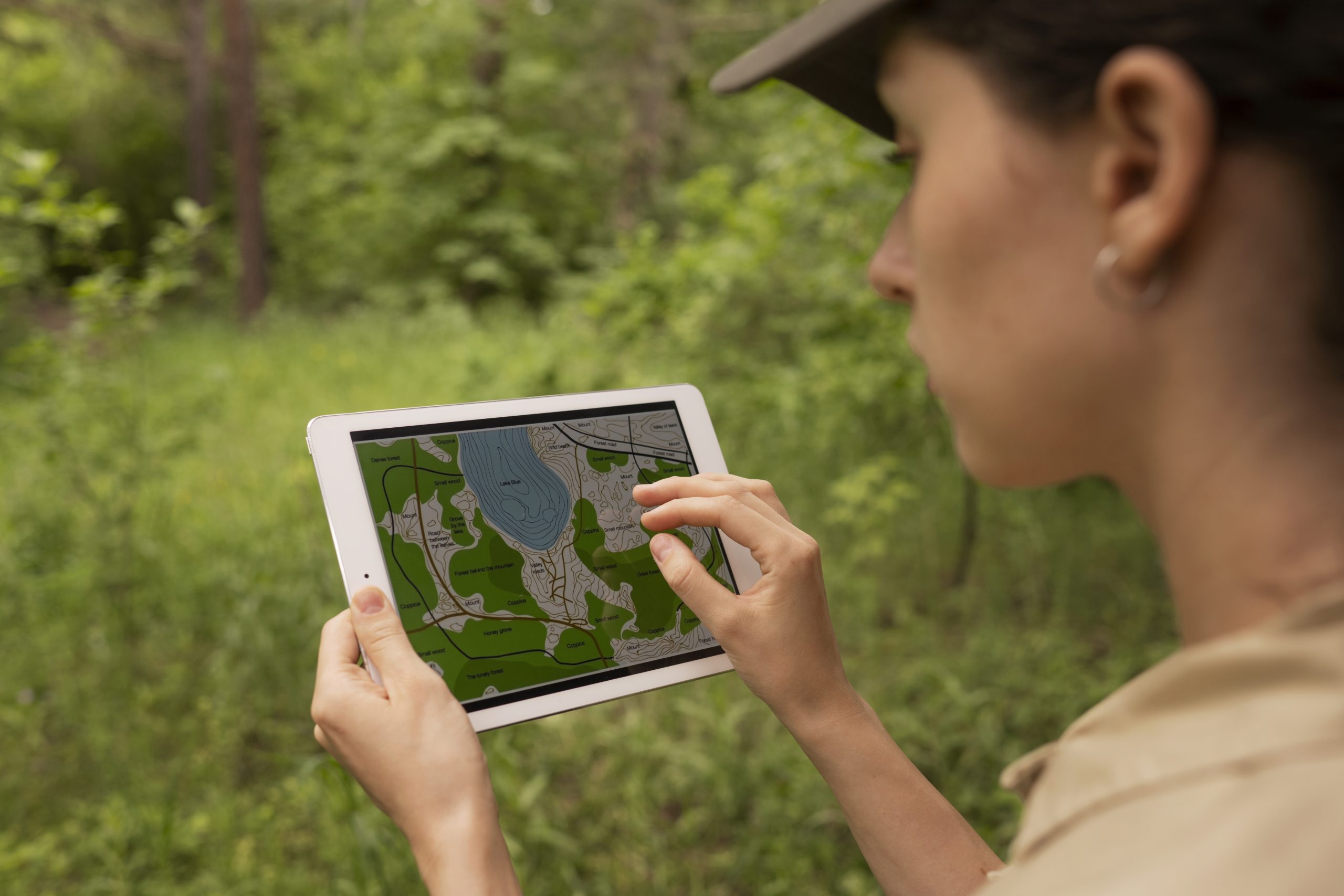
Geospatial data refers to information tied to a specific location on Earth. In agriculture, this encompasses a vast array of resources, including:
- Satellite imagery: High-resolution satellite images capture detailed insights into field health, allowing farmers to identify areas with varying moisture levels, nutrient deficiencies, or potential pest infestations.
- Drone technology: Drones equipped with multispectral sensors provide even closer inspection, enabling farmers to pinpoint problem areas with incredible precision.
- Soil sampling data: Detailed analysis of soil samples reveals crucial information about nutrient composition, pH levels, and overall health, guiding fertilizer application strategies.
- Weather data: Historical and real-time weather data helps farmers predict weather patterns, optimize irrigation schedules, and make informed decisions about planting and harvesting times.
- Elevation data: Digital elevation models (DEMs) provide insights into field topography, which can influence factors like drainage, sun exposure, and crop suitability.
- Crop yield data: Historical yield data from previous seasons allows farmers to identify areas that consistently underperform and implement targeted interventions to improve yields in those specific zones.
These diverse data sets are integrated using Geographic Information Systems (GIS) – powerful software that allows farmers to visualize and analyze the information on interactive maps. Here’s where the magic happens:
- Yield Mapping: By overlaying historical yield data on geospatial information, farmers can identify areas that consistently underperform and implement targeted interventions to improve yields in those specific zones.
- Variable Rate Technology: Geospatial data empowers farmers to employ variable rate technology, which adjusts fertilizer, seed, and water application based on a field’s specific needs. This not only optimizes resource use but also minimizes environmental impact by preventing excessive application in areas that don’t require it.
- Precision Scouting: Armed with insights gleaned from geospatial analysis, farmers can focus their scouting efforts on specific areas exhibiting signs of stress or disease, enabling earlier intervention and minimizing crop loss.
Unlocking the Benefits of Geospatial Data
The integration of geospatial data into agricultural practices offers a multitude of advantages:
- Increased Yields: By precisely addressing the unique needs of different zones within a field, farmers can achieve significant yield improvements. Studies have shown that geospatial data-driven practices can increase yields by up to 30% in some cases.
- Enhanced Resource Efficiency: Precision agriculture techniques enabled by geospatial data allow for the targeted application of resources like fertilizer, water, and pesticides. This not only reduces waste but also minimizes the environmental footprint of agricultural activities.
- Improved Decision-Making: Data-driven insights empower farmers to make informed decisions about planting, irrigation, and pest control. They can proactively address potential issues before they escalate into major problems, leading to improved crop health and overall farm profitability.
- Sustainability and Environmental Protection: By optimizing resource use and minimizing excess application, geospatial data fosters a more sustainable approach to agriculture. This, in turn, helps conserve water resources, reduce soil erosion, and minimize agricultural pollution.
- Improved Risk Management: Geospatial data allows farmers to assess and mitigate risks associated with weather events, pest outbreaks, and plant diseases. By proactively identifying areas susceptible to these challenges, farmers can take preventive measures to minimize potential losses.
- Enhanced Market Access: Data-driven insights on crop health and yield potential can empower farmers to make informed decisions about harvesting and marketing their produce. This can help them secure premium pricing for high-quality crops and connect with buyers seeking specific agricultural products.
- Streamlined Farm Operations: Geospatial data can be integrated with farm management software, streamlining day-to-day operations and record-keeping. This allows farmers to track resource use, analyze trends, and optimize their overall farm management practices.
The Future of Agriculture: Data-Driven and Sustainable
The integration of geospatial data into agriculture represents a significant leap forward. As technology continues to evolve, we can expect even more sophisticated applications to emerge:
- Advanced Data Analytics: Machine learning and artificial intelligence will play an increasingly prominent role in analyzing geospatial data and generating actionable insights for farmers. Predictive models will allow farmers to anticipate potential challenges like pest outbreaks or weather disruptions, enabling them to take proactive measures to mitigate risks.
- Integration with Automation: Geospatial data will seamlessly integrate with automated farm equipment, such as self-driving tractors and precision planters, further optimizing resource use and enhancing farm efficiency.
- Hyper-local Weather Monitoring: Dense networks of weather sensors deployed across fields will provide real-time, hyper-local weather data, allowing for micro-adjustments to irrigation and pest control strategies within a single field.
- Blockchain for Traceability and Transparency: Blockchain technology can be leveraged to create a secure and transparent record of a product’s journey from farm to fork. Geospatial data can be integrated into this system, providing consumers with insights into the origin and production practices associated with their food.
- Robotics and Autonomous Systems: The integration of robotics and autonomous systems into agriculture will be further fueled by geospatial data. Autonomous robots can be deployed for tasks like weed removal, targeted pesticide application, and even harvesting specific crops based on real-time data analysis.
- Vertical Farming and Controlled-Environment Agriculture: As urban populations grow and competition for land intensifies, vertical farming and controlled-environment agriculture (CEA) are poised for significant growth. Geospatial data will play a critical role in optimizing resource use, maximizing yields, and ensuring optimal growing conditions within these specialized environments.
By harnessing the power of geospatial data and these emerging technologies, agriculture can become not only more productive and efficient but also more sustainable and resilient in the face of a changing climate and a growing global population. The future of agriculture is brimming with exciting possibilities, and geospatial data stands as a powerful compass guiding us towards a new era of agricultural innovation.
Conclusion
In conclusion, geospatial data is no longer science fiction; it’s a transformative tool empowering farmers today. By leveraging this rich data stream alongside Envision Beyond’s unmatched expertise in agricultural analytics, farmers can unlock a future of agriculture that is not only productive and sustainable, but also radically efficient and data-driven. Imagine a world where farms become hyper-localized ecosystems, with every resource precisely allocated to maximize yield and minimize environmental impact.
Envision Beyond can help turn this vision into reality, empowering farmers to make data-driven decisions about planting, irrigation, and pest control, all while fostering a sustainable approach that safeguards our planet for generations to come.